Find Your Perfect School
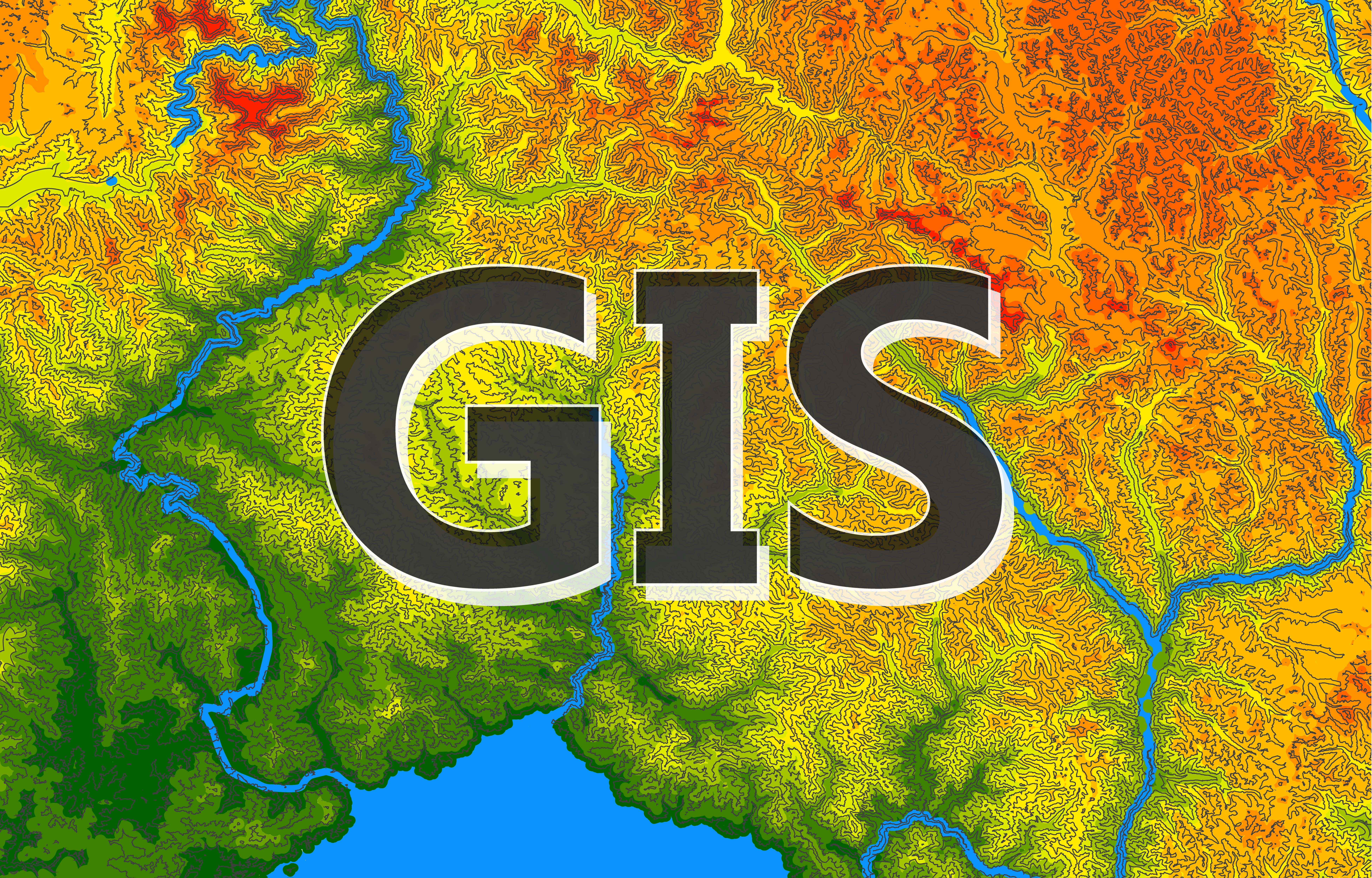
Geographic Information Systems (GIS) is an ever-evolving field with emerging, state-of-the-art technologies at its core. GIS has come a long way from its inception, advancing from its humble beginnings of workstation-based software to modern tools conveniently accessible through mobile devices.
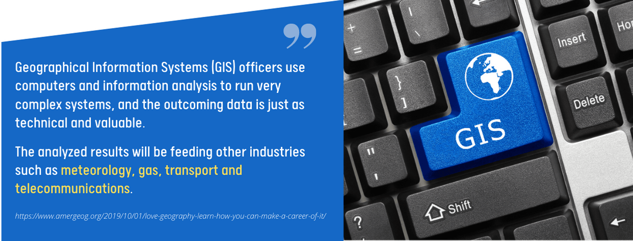
GIS specialists are primarily tasked to build and maintain GIS databases. They do this by analyzing the spatial and non-spatial information in GIS software. They are also tasked to encode various data types into the system, such as tabular data, satellite imagery, map images, and latitude and longitude coordinates.
The job titles in this field include GIS technicians, GIS analysts, and cartographers. GIS professionals earn substantial income yearly. For example, cartographers have a median annual wage of $71,890.
Quick audio summary:
Most GIS specialists earn a bachelor’s degree in Cartography, Geography, Geomatics, Surveying, and other related fields. You may also complete a Certificate in Geographic Information Systems as employers often accept this credential instead of a Geography degree.
A Geographic Information System Certificate Program is composed of short courses that prepare students for a thriving career in the GIS field. GIS Certificate courses result in a deeper understanding of the ins and outs of GIS and a mastery of the fundamental skills integral to urban and regional planning, environmental research, resource management, and numerous branches of the government that utilize such skills.
Nowadays, it is common to earn a Certificate in Geographic Information Systems online! Often asynchronous, these online programs allow students to learn at their own pace, wherever and whenever it is most suitable for them.

The researchers and writers here at PremiumSchools.org use only the most reliable resources to gather the most up-to-date data for this list of the Best Online Geographic Information Systems (GIS) Certificate Programs.
The following are our criteria for this ranking:
- Fully online or hybrid Online Geographic Information Systems (GIS) Certificate classes with flexible and convenient schedules for self-paced learning,
- Top-quality Online GIS Certificate coursework that features the latest industry theories, principles, and applications to promote the student’s professional competence in various workplace settings,
- Experienced and well-credentialed faculty,
- Excellent reputation among industry insiders, journalistic institutions, and higher education agencies,
- Proper accreditation,
- An array of financial aid options for qualified Online GIS Certificate students.
For more information, please visit our Methodology Page.
The Best Online Geographic Information Systems Certificate Programs

Elmhurst University
Offered entirely online, Elmhurst University’s Geographic Information Systems certificate program is easy to fit around one’s busy schedule. This certificate is a great choice for anyone who wants to explore the dynamic field of GIS, whether within the scope of crime analysis, emergency management, or national security.
Taught by an outstanding faculty, this GIS program requires students to complete the five required courses, making up a total of five credits (equivalent to 20 semester hours). This program’s five courses are Introduction to Geospatial Technologies, Remote Sensing Technologies, GIS Programming, Geospatial Capstone, and Implementing Geodatabases.
Students can learn at an accelerated pace, allowing them to finish the program in less than a year. No prerequisites are required. Students can even get their previous college coursework credited in this certificate program.
Types of Aid: Private Loans, Scholarships, Grants, Military and Veterans Benefits
Admission Requirements:
- Completed online application
- Proof of English proficiency
- High school diploma or GED
- Basic computer skills
Accreditations:
- Higher Learning Commission (HLC)

Harper College
Geospatial technology is a high-growth industry. Earning a Geographic Information Systems (GIS) certificate from Harper College can help one carve a career in this field. In this program, students can learn how to apply both GIS and GPS (Global Positioning Systems) technology in various settings, whether in the government, planning, health, tech, or public safety sectors.
This certificate program is 100% online, which means busy professionals can find a way to juggle their workload and coursework. Apart from the knowledge and skills in GIS and GPS, students will also learn how to master earth imagery from satellites and drones. On top of these, they will also gain hands-on experience in various specializations, including database design, spatial analysis, and cartographic design.
Students are expected to complete the required 18 credit hours. The requirements include five courses and one elective. Those who earn this certificate can boost their qualifications for entry-level positions such as analysts and technicians.
Types of Aid: Private Loans, Scholarships, Grants
Admission Requirements:
- Complete the online application with a $25 non-refundable fee
- Official transcripts
Accreditations: Higher Learning Commission (HLC)
Find more information on Harper College’s online Geographic Information Systems certificate program.
Glenville State College
Glenville State College provides those who want to explore the geospatial technology field with ample opportunity and advantage to make it work. Their certificate in geographic information systems program emphasizes visualization, mapping, processing, and analyzing geospatial data.
Students will learn how to combine information and maps innovatively to create and produce tools that are integral to managing the environment, natural resources, communities, and other industries. It does not matter whether one is still pursuing a degree from an unrelated field or already working.
The certificate program can still help them prepare for a career in the geospatial technology field, equipping students with the skills and knowledge to boost their qualifications and give them a competitive edge in the workforce.
Some of the courses required for this program include GIS Application I, Computer-Assisted Mapping, and Introduction to Drone Technology. Students need to render 12 credit hours to earn the certificate.
Types of Aid: Private Loans, Scholarships, Grants
Admission Requirements:
- Completed online application
- Official transcripts
Accreditations: Higher Learning Commission (HLC)

Ferris State University
The Ferris State University’s online Geographic Information Systems certificate program is designed to provide fundamental knowledge and skills essential in implementing GIS in various industries. In this program, students will explore the fundamental principles of GIS and its software and hardware applications.
Other study areas include database concepts, cost-benefit analysis, project management, spatial data algorithms, and digital data dissemination. Students are expected to learn how to use the vector GIS applications software in various case studies. They will also explore various spatial data collection techniques, including photogrammetric mapping, land surveying, remote sensing, and mobile mapping.
The core classes for this program include Fundamentals of Geographic Systems and Geographic Information 2. Students can earn this certificate 100% online, allowing them to take care of their coursework when and where it suits them.
Types of Aid: Private Loans, Scholarships, Grants
Admission Requirements:
- Complete the online free application
- Official transcripts
- ENGL 150 with a C grade or higher, or permission from an instructor
Accreditations:
- Higher Learning Commission (HLC)

University of Maine
Students who want to build their knowledge and skills in Geographic Information Systems can consider earning the University of Maine’s certificate program. The graduate certificate in Geographic Information Systems helps students explore this field’s key aspects, advancing their careers as GIS specialists.
The program has 15 credits composed of three courses and a set of electives. The core courses included are Introduction to Geographic Information Systems, Database System Applications, and GIS Applications. Information Systems Programming, Spatial Database Systems, and Human-Computer Interaction are some of the course electives.
Potential graduates for this program can gain entry into various industries that utilize substantial background in geospatial technology. This includes the transportation and utility sector, cartography and mapping, and environmental resource management.
Types of Aid: Private Loans, Scholarships, Grants
Admission Requirements:
- Undergraduate degree
- GPA of at least 3.0
- Official transcripts
- Essay
- Completed online application
Accreditations:
- New England Commission of Higher Education (NECHE)
University of California – LA Extension
A collaboration between the UCLA Department of Geography and the University of California LA Extension, the GIS and Geospatial Technology Certificate is fully available online for those who want to explore geographic information systems (GIS) geospatial technology.
The certificate program provides techniques and methods for computer-based mapping and spatial analysis. Students will learn all of these with the aid of project-based instruction and GIS software platforms.
They are expected to design, develop, and manage geospatial databases. Creating maps and analyzing data using various GIS platforms are also part of the curriculum. Students can also explore how to conduct data analysis, communicate with cartography, and produce maps.
The online format allows working professionals to work around their hectic schedules. They are not required to have prior GIS experience to enroll in the program. This certificate program can gain them entry into the GIS field and other related geospatial industries.
Types of Aid: Private Loans, Scholarships, Grants, Military and Veterans Benefits
Admission Requirements:
- Submit an online application with a $200 application and candidacy fee
Accreditations:
- WASC Senior College and University Commission (WSCUC)

University of Denver
The University of Denver is the first in the region to offer a graduate certificate program in Geographic Information Systems that is fully available online. Apart from the knowledge and skills that students can gain from this program, they will also acquire hands-on experience in implementing various GIS projects from start to finish, including internet mapping, remote sensing, and digital image processing.
The graduate certificate is composed of 6 courses amounting to a total of 24 credit hours. Two of these are concentration courses, which include Introduction to Geographic Information Systems and Cartography and Geovisualization.
Students are given all elective courses from the Geographic Information Systems program to choose from, including Geospatial-Intelligence, GIS in Telecommunications, Crime Mapping and Analysis, Public Domain Data for GIS, and GIS Disaster Management many others.
Students can earn the graduate certificate in as few as six months to a year.
Types of Aid: Private Loans, Scholarships, Grants
Admission Requirements:
- Baccalaureate degree from an accredited institution
- Minimum 2.5 accumulative GPA on a 4.0 scale
- Completed online application
Accreditations:
- Higher Learning Commission (HLC)

Michigan State University
The professional Geographic Information Systems certificate offered by the University of Michigan is a good educational foundation for those who wish to venture out into the geospatial field and enhance their qualifications. The certificate can be earned by taking the program individually or by combining the professional development courses.
Students are equipped with valuable knowledge and skills in various geospatial tools and technology. The courses included in the program are Introduction to Geospatial Technology, Remote Sensing, Geographic Information Systems, and Cartography.
There are also two specialization courses on offer on top of the four core courses mentioned, including Criminal Justice Applications and FAA Part 107 Drone Test Prep & Beyond. At the end of the program, they are expected to learn map designing, geospatial analysis, and many others.
The certificate program is designed for those who want to learn new skills, enhance their resume, or earn continuing education and teaching credits.
Types of Aid: Private Loans, Scholarships, Grants, Refer-a-Friend Discount, Military and Veteran Benefits, MSU GEO Alum Discount
Admission Requirements:
- Completed online application
- Official transcripts
Accreditations:
- Higher Learning Commission (HLC)

University of Washington
GIS has various applications in industry, government, and even academia. The University of Washington’s Certificate in Geographic Information Systems provides in-depth knowledge about the field of GIS and its applications.
Students are taught to build a GIS database in this program involving raw data and scanned maps, GPS positions, and aerial photography. They will understand how these are used in research and decision-making for many fields, from land-use planning to disaster preparedness.
They will deal with various types of geospatial data. They are also expected to explore the different aspects of designing, developing, and managing GIS projects. They can also specialize in GIS applications that are specific to the Pacific Northwest and Puget Sound region.
While the learning format is fully online, students can still experience real-time interaction with their instructors and fellow students through chat, web conferencing, and phone calls.
Types of Aid: Private Loans, Scholarships, Grants
Admission Requirements:
- Bachelor’s degree or two years of college education with professional experience
- Ability to use ArcGIS Desktop 10, 9, 8.x, or ArcView 3.x for basic functions
- Completed online application
Accreditations:
- Northwest Commission on Colleges and Universities (NWCCU)

University of Vermont
Known for its leadership in geospatial technology and research, the University of Vermont offers a professional certificate in Geographic Information Systems and Data Communication. This program covers Geographical Information Systems (GIS), including its core concepts and real-world applications.
Students can also learn the various aspects of geospatial computation, data communication, and remote sensing. The program focuses on helping students develop critical thinking and improve their applied problem-solving skills.
Composed of four courses, this 100% online program equips students with relevant skills such as map-making, data visualization and communication, data management, web mapping, and many others. They will learn how to use various software tools and understand the concept of GIS and its applications.
The program can be earned within 8 to 12 months.
Types of Aid: Private Loans, Scholarships, Grants
Admission Requirements:
- Bachelor’s degree or higher
- Completed application
- Transcripts
- Letters of recommendation
- Personal statement
Accreditations:
- New England Commission of Higher Education (NECHE)

University of North Dakota
Those interested in delving deeper into spatial data and processes without going through four rigorous years of a degree program can consider earning the University of North Dakota’s certificate in Geographic Information Sciences instead.
In this certificate program, the core foundations of the GIS are tackled, including its what and where. It encompasses various aspects of GIS, including surveying, mathematics, remote sensing, programming, and geography. They will also cover the important concepts involved in storing spatial information and analyzing data.
While there is an emphasis on a solid theoretical foundation, students will also gain technical skills integral to digital model landscapes and mathematical characterization of spatial and temporal processes.
Designed for non-degree-seeking professionals, this certificate program is offered part-time and 100% online. It is possible to apply the credits earned from this program to a master’s degree in geography.
Types of Aid: Private Loans, Scholarships, Grants
Admission Requirements:
- Completed online application
- Transcripts
Accreditations:
- Higher Learning Commission (HLC)

University of Memphis
Aimed to help students develop their geographic knowledge and geospatial technology skills, the graduate certificate in Geographic Information Systems (GIS) from the University of Memphis is a blend of research and hands-on experience.
Students are taught to use the latest data sourcing and online GIS learning techniques. They should also master the ways of leveraging GIS software to store and analyze spatial data. Apart from the basic GIS data analysis, students are also equipped with critical thinking and problem-solving skills to solve complex problems in various industries.
The program consists of three required courses, including Geographic Information Science, Capstone GIS Project, and Advanced Geographic Information Science.
Types of Aid: Private Loans, Scholarships, Grants
Admission Requirements:
- Completed online application
- Letter of intent
- Official Transcripts
Accreditations:
- Commission on Colleges of the Southern Association of Colleges and Schools

California State University
The California State University at Fullerton offers a Geographic Information Systems (GIS) certificate designed for those who want to delve deep into geography, data, and systems. The skills and knowledge they earn from this program help solve various problems from different sectors, from government and business to healthcare, law enforcement, and other industries.
Students will learn the most effective ways of analyzing and presenting geographic data, integrating geography, data, and systems to solve problems and serve various industries. There are a total of four required courses comprising a total of 84 hours of lecture. The program can be completed within eight months.
This certificate is most suitable for recent baccalaureate graduates, professionals utilizing GIS in their work line, and professionals looking for a career change.
Types of Aid: Private Loans, Scholarships, Grants
Admission Requirements:
- Completed online application
- Official transcripts
Accreditations:
- WASC Senior College and University Commission (WSCUC)

University of Redlands
Designed for working professionals, the Online GIS Certificate from the University of Redlands provides a basic understanding of Geographic Information Systems (GIS). It tackles the effective ways to manage spatial databases, extract information from sense data, and develop web GIS applications.
The certificate program is fully available online. Students are free to take the courses at their own pace. They can also be assured of quality learning from an experienced faculty. Students need to complete 11-13 credits to earn the certificate, including one required course, the Fundamentals of Geographic Information, Techniques and Applications.
The remaining credits can be earned through choosing three electives, including Geographic Database Management Systems, Programming for GIS with Python, GIS for the Web, and Remote Sensing and Image Analysis.
The credits you earn from this program can be applied towards a Master of Science in GIS.
Types of Aid: Private Loans, Scholarships, Grants
Admission Requirements:
- Complete resume
- Official transcripts
Accreditations:
- Western Association of Schools and Colleges (WASC)

Cuesta College
Geospatial technology is a career field that this program is designed for. It is useful for professionals in many fields to gain new skills and gain new expertise. As well as providing an edge for continuing education and employment, the certificate can also be used to supplement a degree in other study areas.
Upon studying this GIS program, you’ll be able to grow your practical knowledge and have hands-on training opportunities. Four courses can be completed in one year for $552 in tuition. Software such as ArcGIS Online, QGIS, and ESRI ArcGIS are used in Cuesta College GIS courses.
Types of Aid: Scholarships, Federal Work Study, and Affordable Connectivity Program
Admission Requirements:
- Completed Online Application
- Official Transcripts
Accreditation: ACCIC or Accrediting Commission for Community and Junior Colleges of the Western Association of Schools and Colleges
Find more information on Cuesta College’s online Geographic Information Systems certificate program.

Penn State World Campus
Adding a GIS certificate to your resume in nine months will boost your career prospects.
Through a partnership with the Department of Geography at Penn State College of Earth and Mineral Sciences, Penn State World Campus offers a fully online GIS certificate tailored to adult learners’ diverse needs and busy schedules.
With this certificate program, you’ll be able to develop your skills in analyzing, communicating, and solving location-based challenges. You can use desktop GIS software to design and maintain database systems.
By choosing electives such as open web mapping, real-world applications of GIS, advanced Python programming, spatial data science, emerging trends in remote sensing, and business location intelligence, you can customize your program.
Types of Aid: Scholarships, Payment Options, and Military Payment Options
Admission Requirements:
- Baccalaureate degree from an accredited school
- Completed Online Application Form
- English Proficiency
Accreditation: Middle States Commission on Higher Education

Elmhurst University
From crime analysis to emergency management to national security, you can start or expand your career with a certificate from Elmhurst University. Data collection and analysis, map-making, and spatial problem-solving will be taught in small classes. Elmhurst can provide you with all the tools you need to achieve your GIS goals.
The GIS faculty at Elmhurst have extensive experience working at Argonne National Laboratory as well as with private businesses and local governments. Above all, they care about your success. In addition to their class time, these instructors spend time working with students individually.
Types of Aid: Scholarships, External Scholarship Sources, Grants, Campus Employment, and Loans
Admission Requirements:
- Completed Online Application Form
- Official Transcripts
- Application Essay
- English Proficiency
Accreditation: Higher Learning Commission

Troy University
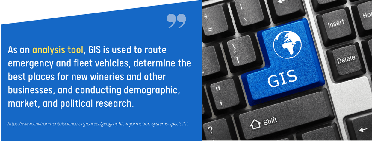
Businesses all over the world, local governments, and our way of life are being revolutionized by GIS. Using GIS, users, analysts, and decision-makers can see patterns and relationships in a given area or subject by visually presenting data in many different ways. A 2D map, a 3D map, or an animated 4D map usually displays these patterns.
In order to assist decision-makers in making an informed decision, GIS can be used to analyze critical topics like:
- soil types
- land availability
- sustainability mapping
- traffic movements
- population distribution
- real estate prices
- environmental hazards,
- utility inventories
- flood zones
Getting started with GIS is easy. Your job may require you to learn GIS as part of your duties. A GIS certificate can support your field of study and help you land a job doing GIS. Taking all four classes consecutively and passing all of them is required to earn the GIS Certificate online. Before moving on to the next class, each class must be completed within one month.
Types of Aid: Scholarships and Federal Student Aid
Admission Requirements:
- Completed Online Application Form
- GPA of 3.0
- ACT or SAT Scores
Accreditation: Southern Association of Colleges & Schools Commission on Colleges

University of Tennessee Chattanooga
GIS (Geographic Information Systems) can be found in nearly every industry and academic discipline, and are integral to daily living, whether we are directly involved in them or use them as citizens. Learn how to use GIS effectively by taking advantage of this GIS certificate program, enhancing your career opportunities.
This online program allows students to learn GIS fundamentals and technical software to teach practical skills, and the chance to use maps and GIS resources creatively. In order to gain a deeper understanding of the world, the university wants to educate students about geospatial technology and knowledge.
This certificate can be taken in an asynchronous format. Those with basic technical computer skills can take this non-credit certificate offered by UTC’s Center for Professional Education.
Types of Aid: Grants, Scholarships, Student Loans, and Student Employment
Admission Requirements:
- Completed Online Application Form
- Application Fee of $30
- Official Transcripts
- ACT or SAT Scores
Accreditation: Southern Association of Colleges & Schools Commission on Colleges (SACSCOC)

What can I do with an online geographic information system (GIS) certificate?
The courses offered in this certificate program are good preparation for anyone who wants to make a career in the GIS industry. They will focus on learning how to map, visualize, process, and analyze geospatial data.
Non-traditional students, undergraduates from different academic departments, and even working professionals who want to explore the field of geographic information systems in depth can benefit a lot from this certificate program. Their GIS software proficiency is a valuable credential that can advance their careers and usher in bigger compensation.
A certificate program in geographic information systems can also be used as an educational foundation for pursuing a degree or getting a certification.
Does an online geographic information system (GIS) certificate offer the same benefits as its traditional counterpart?
Most online certificate in geographic information system programs is taught by the same competent and experienced faculty as their traditional equivalent. They also use the same core curriculum with rigorous courses that could equip them with essential skills and knowledge. The only difference is the delivery method.
Online students can even benefit more from the flexible format that allows them to fit their advanced learning pursuits around their busy schedules.
Working professionals would not have to be under great pressure to attend face-to-face classes that can affect their blossoming careers. They can always learn at their own pace with an online certificate program in Geographic Information Systems.
The credits they earn from online programs are enough to earn them positions in various industries that utilize GIS skills, from planning and agriculture to marketing and government industries.
How long does an Online Geographic Information System (GIS) certificate program take to complete?
Most certificate programs in Geographic Information Systems (GIS) that are fully available online allow asynchronous learning, which means students have the freedom to go through the courses at their own pace.
This affects the length of time that an online certificate can be completed. However, most geographic information system (GIS) certificate programs’ average completion duration is within a year.
While courses have specific start and end dates, courses are designed to be completed independently. There are no required login times in this case. One can expect to devote an approximate period every week, often somewhere between 8 to 12 hours. But it can be less depending on one’s preference and schedule.
Will I enjoy a career in GIS?
A career in Geographic Information Systems, or GIS, is awesome for those interested in geography, the lay of the land, mapping, or other types of information systems data. It can be used in all sorts of applications, such as urban planning, emergency management, public health, and much more.
Do GIS jobs pay well?
Entry to mid-level GIS salaries begin at approximately $71,890 per year; however, with advanced training and experience, you can expect to earn upwards of $107,600 or more annually.
What are the work conditions for GIS employees?
This career combines indoor and outdoor work conditions. Many hours of office work are required to record data; however, at times, going to a site may also be required, often in either extremely hot or cold conditions. In addition, GIS, in most instances… is a full-time position and travel is often a requirement.
Let us share some additional resources with you that students find helpful: